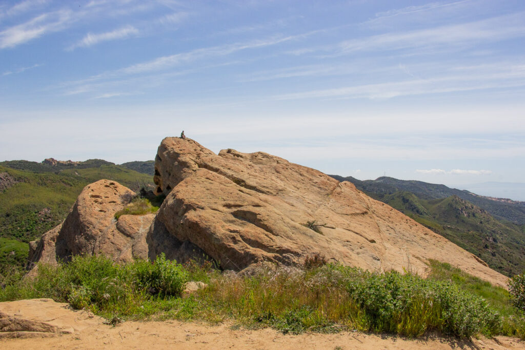
Los Angeles, with its diverse landscapes and stunning vistas, offers a plethora of hiking trails for outdoor enthusiasts. Whether you’re a seasoned hiker or a beginner, there’s something for everyone. Let’s dive into some of the best trails in the area:

1. Malibu Creek State Park (Crags Road Trail)
Description: The Crags Road Trail in Malibu Creek State Park offers a scenic hike through oak woodlands, past a rock pool, and along the creek. Keep an eye out for the iconic M*A*S*H TV show filming location. The trail is relatively easy, making it suitable for hikers of various skill levels.
Hiking, Mountain Biking, Horseback riding
- Distance: Approximately 3.4 miles
- Elevation Gain: 279 feet
- Hike Time: About 2-3 hours
- Trail Map: Malibu Creek State Park Trail Map
- Official Website: Malibu Creek State Park

2. Pacific Crest Trail (Vasquez Rocks)
Description: The Vasquez Rocks section of the Pacific Crest Trail takes you through unique rock formations, including the famous “Vasquez Rocks” seen in many movies and TV shows. The trail offers panoramic views of the surrounding landscape, making it a great choice for photography enthusiasts.
- Distance: Around 3.4-5.5 miles (loop)
- Elevation Gain: 310 feet
- Hike Time: Approximately 2-3 hours
- Trail Map: Vasquez Rocks Trail Map
- Official Website: Vasquez Rocks Natural Area Park
- Fees & Permits: It’s free!

3. Santa Monica Mountains
Description: The Santa Monica Mountains offer a variety of trails with ocean views, wildflowers, and diverse wildlife. Choose from different routes based on your preferences. The Backbone Trail, in particular, provides stunning vistas of the coastline and is a favorite among locals.
- Distance: Varies (multiple trails)
- Elevation Gain: Varies
- Hike Time: Depends on the chosen trail
- Trail Map: Santa Monica Mountains Trail Maps
- Official Website : Santa Monica Mountains National Recreation Area California

4. Topanga State Park Trails
Description: Topanga State Park boasts several trails through chaparral-covered hills, with options for both beginners and experienced hikers. Enjoy panoramic views of the city and coastline. The Eagle Rock Trail is a must-do, offering breathtaking vistas and a chance to spot local wildlife.
- Distance: Various trails available
- Elevation Gain: Varies
- Hike Time: Depends on the specific trail
- Trail Map: Topanga State Park Trail Maps
- Official Website: Topanga State Park

5. Sandstone Peak
Description: Sandstone Peak, the highest point in the Santa Monica Mountains, offers breathtaking vistas of the ocean and surrounding peaks. Look for the iconic “Tri Peaks” formation. The Mishe Mokwa Trail takes you there and is a favorite among seasoned hikers.
- Distance: Approximately 6.25 miles
- Elevation Gain: 1,075 feet
- Hike Time: About 3-4 hours
- Trail Map: Sandstone Peak Trail Map
- Official Website: N/A

6. Hollywood Sign Trails (Griffith Park)
Description: Explore the trails around Griffith Park to get up close to the iconic Hollywood Sign. Choose from various routes, each offering stunning views of the city and the sign. The Brush Canyon Trail is a popular choice, leading you to a prime viewpoint for that classic Hollywood Sign photo.
- Distance: Varies (multiple routes to the Hollywood Sign)
- Elevation Gain: Varies
- Hike Time: Depends on the chosen route
- Trail Map: Griffith Park Trail Maps
- Official Website: Griffith Park

7. Bridge to Nowhere (via East Fork Trail)
Description: The Bridge to Nowhere hike leads you to an abandoned bridge deep within the San Gabriel Mountains. Cross the bridge and enjoy river crossings along the way. The trail is challenging due to its length and river crossings, but the reward is the unique experience of reaching a bridge seemingly in the middle of nowhere.
- Distance: Approximately 10 miles
- Elevation Gain: 900 feet
- Hike Time: About 5-6 hours
- Trail Map: Bridge to Nowhere Trail Map
- Official Website: N/A

8. Wisdom Tree (Via Cahuenga and Burbank Peaks)
Description: The Wisdom Tree hike takes you to a lone tree atop Cahuenga Peak, offering panoramic views of Los Angeles and the iconic Hollywood Sign. The trail is steep but rewarding, especially during sunrise or sunset. The tree itself has an interesting backstory related to wildfires and resilience.
- Distance: Around 3 miles
- Elevation Gain: 800 feet
- Hike Time: Approximately 1.5-2 hours
- Trail Map: Wisdom Tree Trail Map
- Official Website: N/A

9. Eaton Canyon Falls Trail
Description: The Eaton Canyon Falls Trail is a popular choice for families and beginners. It leads to a beautiful 40-foot waterfall surrounded by lush greenery. The trail includes stream crossings and offers a refreshing escape from the city. Be prepared for crowds, especially on weekends.
- Distance: Approximately 3.5 miles
- Elevation Gain: 375 feet
- Hike Time: About 1.5-2 hours
- Trail Map: Eaton Canyon Falls Trail Map
- Official Website: Eaton Canyon Natural Area

10. Runyon Canyon Park
Description: Runyon Canyon Park is a popular spot for both hiking and celebrity sightings. The trails offer views of the Hollywood Hills, downtown LA, and the Pacific Ocean. Choose from various routes, including the famous “Runyon Canyon Loop.” Keep an eye out for fitness enthusiasts, dogs, and stunning vistas.
- Distance: Varies (multiple trails)
- Elevation Gain: Varies
- Hike Time: Depends on the chosen route
- Trail Map: Runyon Canyon Park Trail Map
- Official Website: Runyon Canyon Park
Hiking Trails in Los Angeles summary
These hiking trails in Los Angeles offer diverse experiences, from hidden waterfalls to city views. Remember to bring water, wear appropriate footwear, and follow trail etiquette. Happy hiking!


Leave a Reply